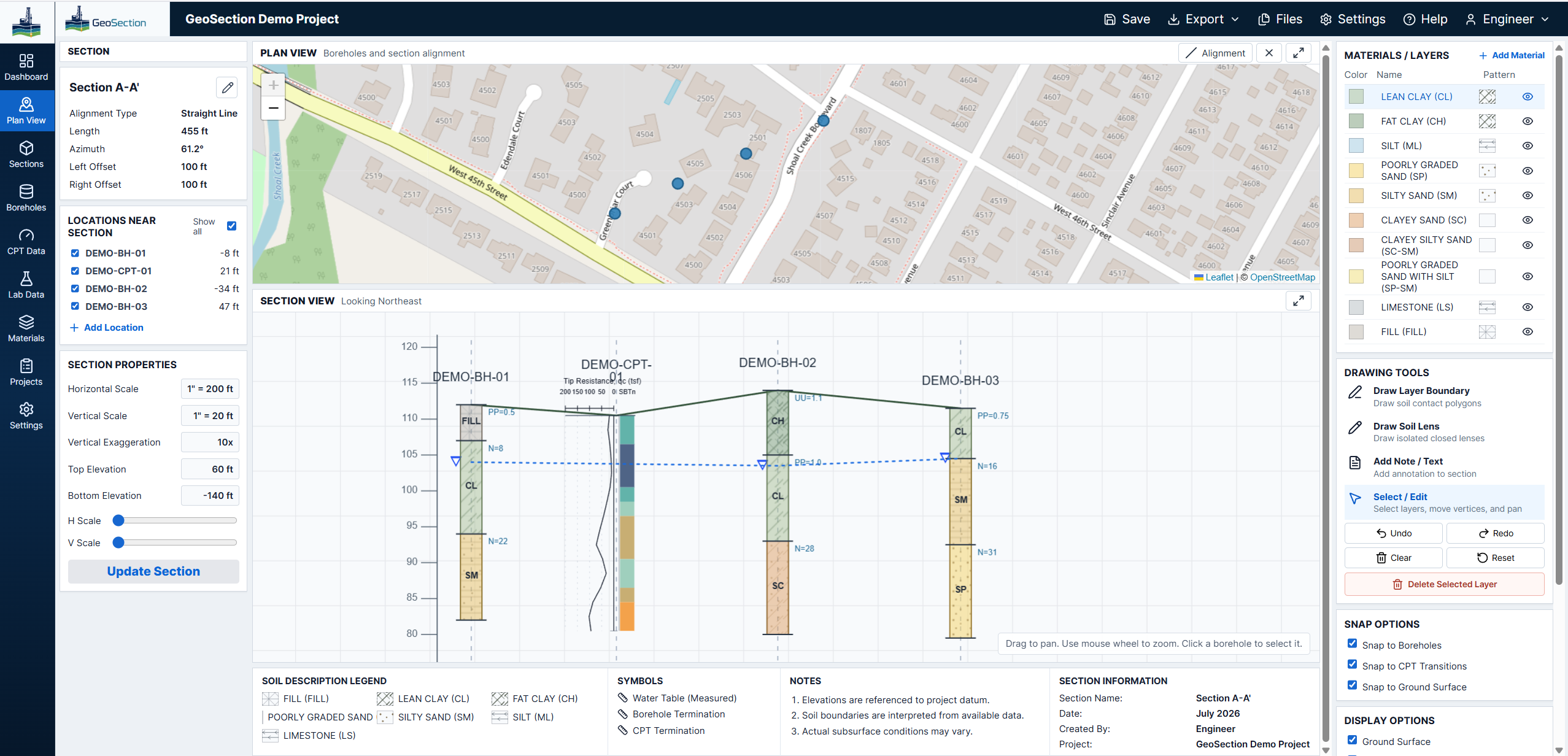
GeoSection workspace with map, section view, borehole logs, and CPT traces

GeoSastra presents GeoSection

Geotechnical cross sections, made workable.

Bring boreholes, CPT soundings, laboratory results, and groundwater observations into one plan-linked workspace for interpretation and delivery.

Built for subsurface work

GeoSection keeps the source investigation, the section alignment, and the interpretation in the same project space.

It is designed for engineers who need to read the log, test result, CPT behavior, and ground model together.

One connected workflow

Start with the investigation. Finish with the section.

Each stage remains connected to the project rather than becoming a separate drawing, spreadsheet, or image export.

  1. 01

    Load the records

    Read point, lithology, sample, groundwater, and CPT files into the project.

  2. 02

    Draw the alignment

    Set a two-point section line in plan view and project selected locations to station.

  3. 03

    Interpret the ground

    Build contacts and soil lenses against real logs, traces, water levels, and material hatches.

  4. 04

    Issue the sheet

    Export a scaled PDF with project information, symbols, legends, and branding.

The project workspace

Evidence beside interpretation.

GeoSection full workspace with map, project controls, and geotechnical section
Work with plan view, section view, project controls, and materials together instead of passing between disconnected tools.

Logs that read continuouslyLithology, test values, water levels, and termination remain attached to each location.

CPTs with contextScaled cone resistance and SBTn classification are rendered beside the section.

Editable geologySnap contacts to logs, shape lenses, layer materials, and maintain a readable profile.

An engineering drawing, not a flattened image

Keep the details that support the call.

01

Soil and rock materials

Distinct USCS fills and hatches give every material a legible identity.

02

Water information

Show observed water levels at individual logs or connect them across the section.

03

Field and lab evidence

Prioritize UU/UC, pocket penetrometer, or SPT N-values beside the stratigraphy.

04

Project continuity

Save or share a portable section session with inputs, alignment, edits, and display settings.

GeoSection by GeoSastra

Bring the next profile into focus.

Open GeoSection